The journey north always carries a subtle shift in mood for me; leaving the familiar roads behind, travelling between the Lake District and the Howgill Fells, the call of the mountains gets stronger. Our first stop came just over the border at Gretna Green. For centuries this small village has been famous for one thing: runaway marriages. In the days when English marriage law required parental consent for anyone under 21, couples would flee north to Scotland where the rules were far simpler. Gretna Green became one of a number of places across the border where they could be legally wed often by the local blacksmith at the village forge.
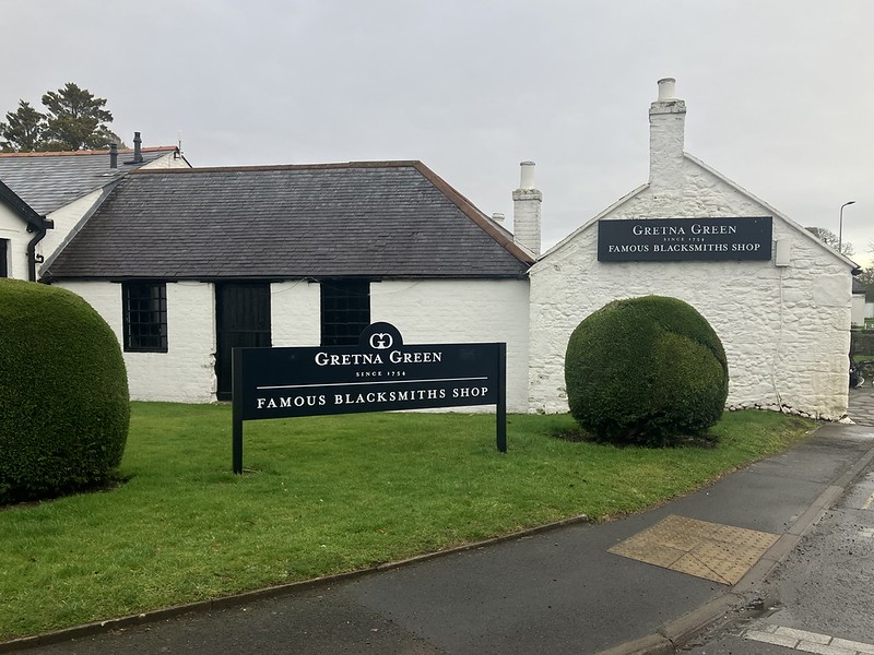
Today the old forge is preserved as a small historic site, complete with the anvil where couples once sealed their vows. For years I have driven past on my way to adventures further north and it was great to stop and explore before the motorway carried us deeper into Scotland. Then the landscape widening as the Southern Uplands slip by and the long pull toward the Highlands begins.
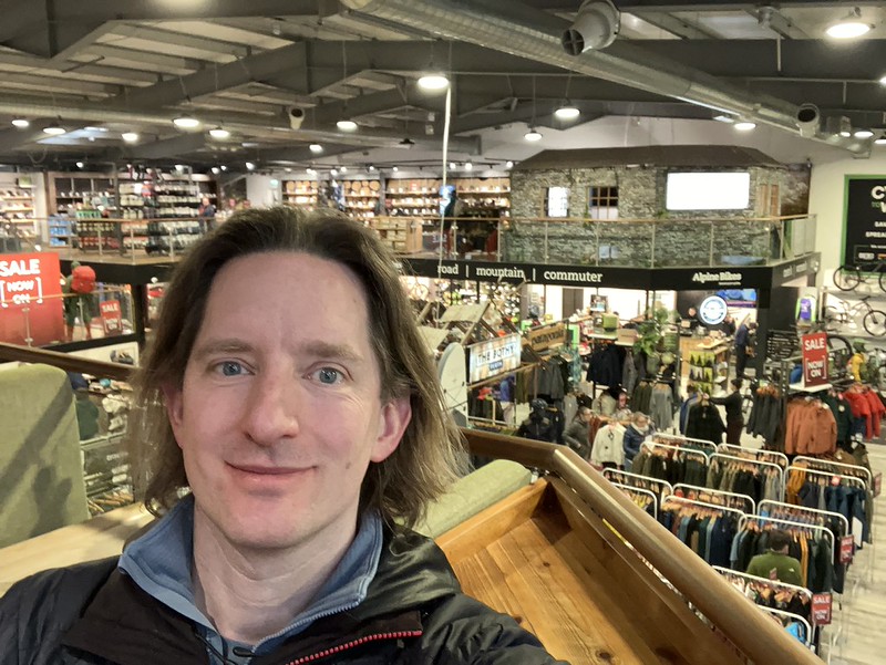
Our next stop was Perth, less romantic perhaps, although I often find I stop at Tiso here for brew and wander around their outdoor shop for forgotten essentials, in this case a map for Mount Keen which was not on my BMC Mountain map for the Cairngorms.
The journey continued north east toward Angus, arriving at Edzell. Which sits quietly at the edge of the Highlands, where farmland begins to give way to glens and heather covered hills. In summer it’s a popular gateway for walkers and cyclists exploring Glen Esk and the surrounding countryside but at this time of year it felt wonderfully still.
Mount Keen
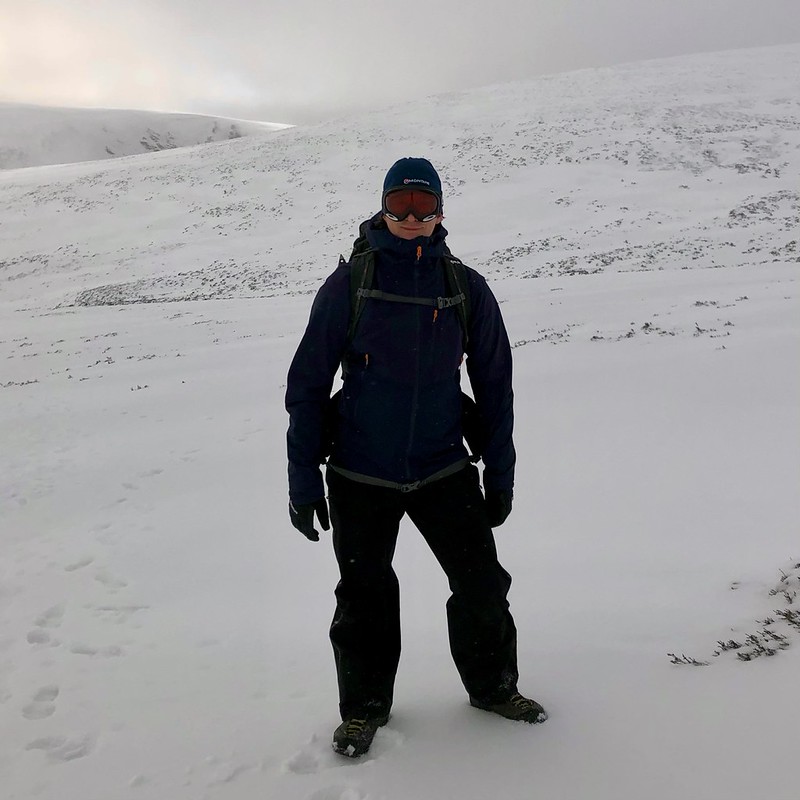
There’s a certain kind of Scottish winter day that doesn’t deliver views, drama or blue skies but quietly teaches you more about the mountains than any perfect summit ever could. We woke up to one of those days. As a trainee Winter Mountain Leader, I’ve come to value these marginal, serious days the most. They’re where judgement sharpens, leadership is tested and skills begin to move from theory into instinct.
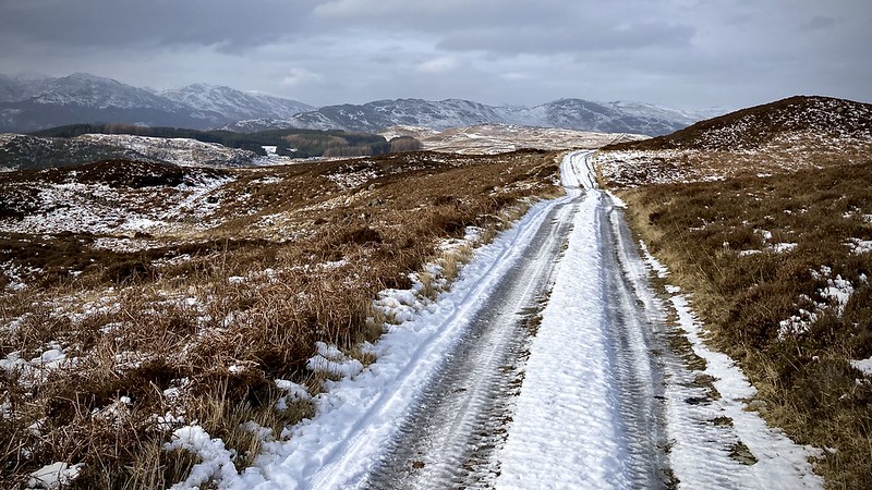
The route I had planned was the long southern approach to Mount Keen. It follows a broad ridge that normally offers a steady, uncomplicated winter journey. On paper it looked straightforward. In reality it delivered full winter conditions: fresh snow, wind-scoured ice, persistent whiteout and a biting cold that quickly stripped away comfort.
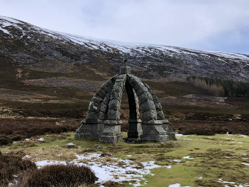
We set off from the small car park near the church in Glen Esk, the morning still quiet and benign. The estate track wound gently upward toward Queen’s Well, water bubbling improbably from frozen ground, before passing the tidy buildings of Glenmark, the last sign of shelter before the open hill.
For a while it felt almost easy. Snow began to gather underfoot as we left the lower glen, the surface crisp and supportive. Each step sank just a few centimetres, ideal conditions for steady, efficient progress. It was one of those rare moments when a winter ascent seems almost welcoming.
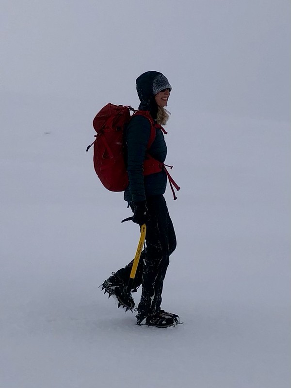
But as the ridge steepened around 800 metres, the character of the mountain changed quickly. The wind had stripped the exposed slopes bare. Snow thinned to polished ice. Patches of neve glistened under a dull grey sky. Crampons came out. I am one to wait till they are needed rather than putting them on as soon as I get to ice. In my experience with the damage they can do to plans living on frozen turf and the complication of spiking yourself or tripping I see them as an essential tool for moving safely and confidently although not a tool to rush too.
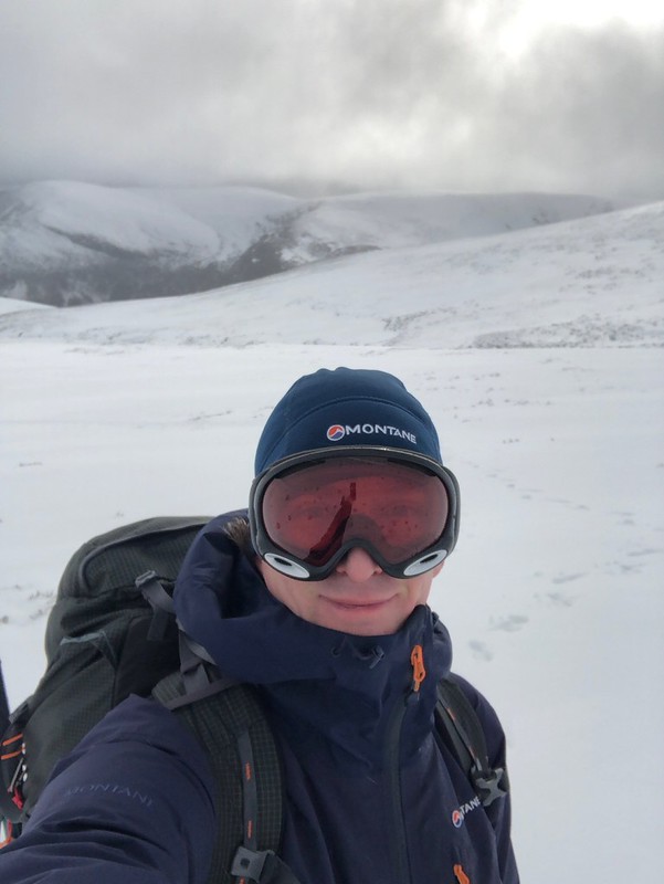
Visibility had been deteriorating steadily, but higher on the ridge the world finally closed in. Goggles went on. Hoods tightened. Spindrift crystals stung exposed skin.
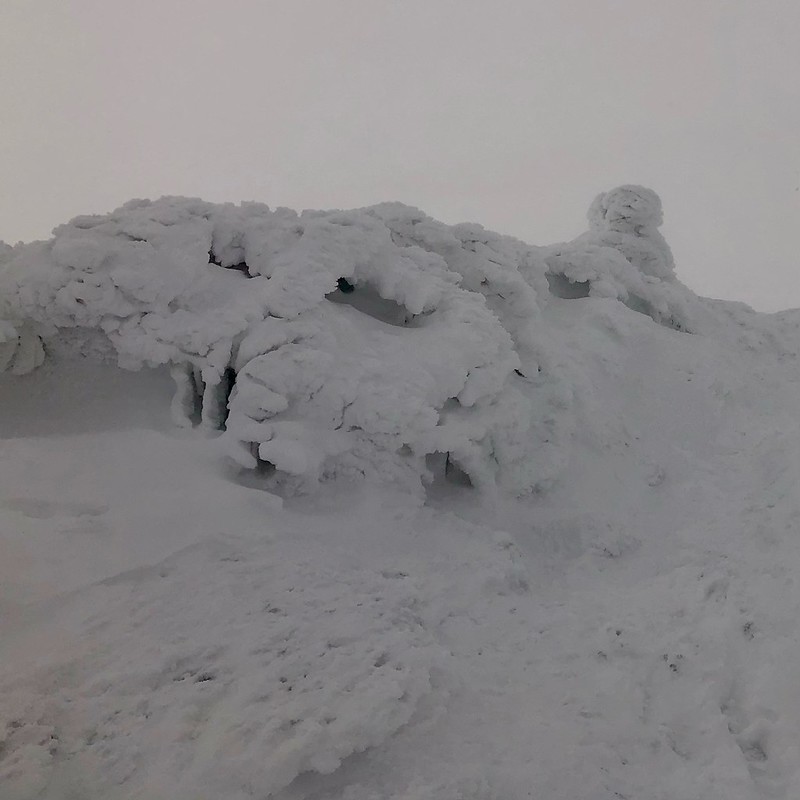
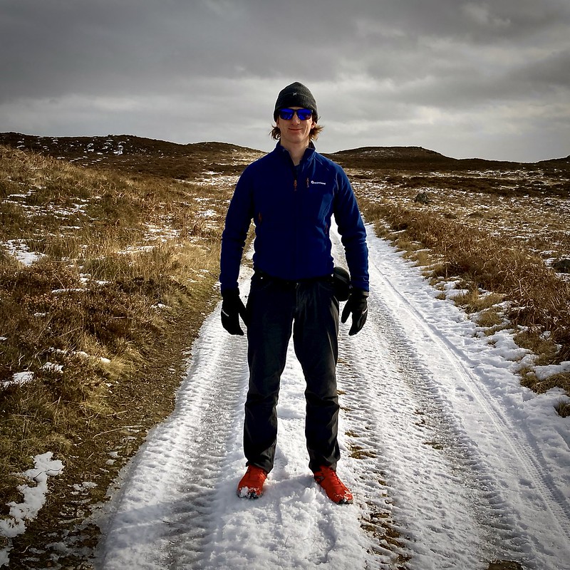
Suddenly the mountain became very simple and very serious: Slope aspects, feeling of the snow under foot, does your heel or toes hit the snow first and compass become my tools of choice as we progressed up to the trig point wrapped in snow and ice. There were no visual references now: no skyline, no horizon, no sense of distance. Just the slow, methodical movement of winter navigation.
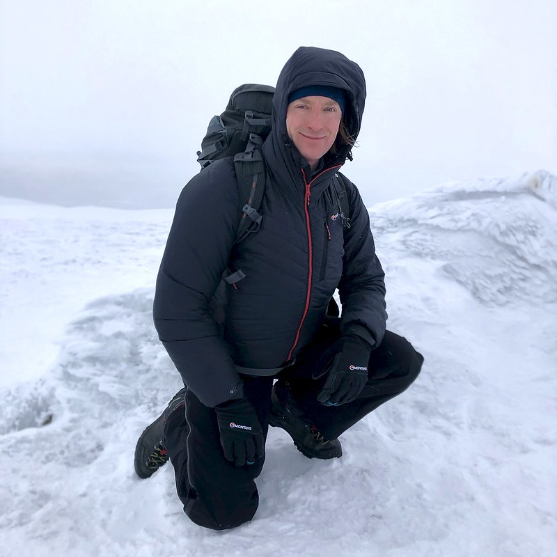
We worked steadily upward, pacing carefully and keeping direction tight, constantly checking position against time and terrain feel. For my companion this was their first winter Munro. The white out brought understandable nerves and part of my role shifted from simply moving efficiently to leading with confidence. Explaining decisions, maintaining rhythm and creating calm where uncertainty naturally creeps in. By around 2:30pm roughly three hours and fifteen minutes after leaving the glen, we reached the summit. No views although I managed a quick snap and the constant thought as much as we should have a straight forward return the top might be the goal although it is not the finish!
Descending the same ridge revealed even more about the terrain. Where we had enjoyed crisp snow lower down on the ascent, the return journey showed how mobile that snow had been. Much of it had vanished from exposed ground, leaving long stretches of bare ice and wind scoured surfaces.
It reinforced something avalanche forecasts often warn about but which you only truly understand when you feel it under your feet: Wind doesn’t just create dangerous slabs. It also strips slopes to glassy hardness. In the white-out we drifted slightly west during the descent; the kind of slow, creeping error that happens easily when wind pressure, slope angle and group focus combine. Catching it early and correcting calmly became on of those learning experience from the day and a quiet reminder that navigation rarely fails suddenly, it slips gradually. Leadership means staying mentally ahead, even when supporting others through difficult conditions.
Once we corrected our line, progress quickened as we lost height and winter slowly loosened its grip. The day finished, fittingly, with one final challenge the pothole riddled Glen Esk road, patched with loose aggregate and demanding almost as much concentration as the descent itself and I was glad to clear the valley in the light and be on our way west.
frost beard
After dinner in Forfar and a night at a local bed and breakfast, we had a more restful day to look forward too. Stopping at Glamis, taking time to wander through the village and along the woodland paths near the castle. We had briefly considered attempting another Munro that day, but a combination of slightly less fitness than we had hoped for and the quiet appeal of a rest day made the decision easy. Sometimes the best choice in the hills is simply to slow down. The woodland offered exactly that; as we followed the paths beside the burn, something caught our eye. At first glance it looked like delicate fungal filaments growing from the wood: fine white strands spilling out like soft hair. But curiosity got the better of us and after a closer look and a bit of investigation we realised we were looking at something else entirely. It was hair ice, sometimes called frost beard. This strange and beautiful formation occurs when water inside dead wood is forced out as temperatures drop below freezing. As the moisture emerges it freezes instantly, forming fine silky strands of ice that can look almost like cotton wool or spun glass. A particular fungus in the wood helps guide the process, preventing the ice from forming larger crystals and instead producing these remarkable hair like structures.
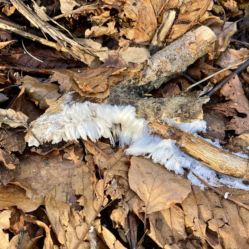
Seeing it there beside in the leaves was a quiet reminder of the weather we’d been having, several cold days and a clear freezing night. Down here in the sheltered valley, far from the summits themselves, the conditions had lined up perfectly. Moments like that are one of the things I love most about being outdoors. Even on a gentle day, even away from the mountains, there is always something new to notice and learn.
After our wander we continued west, stopping briefly in Perth to refuel both car and ourselves before pressing on to the hostel that would be our base for the next few nights.
Ben Chonzie
The following day the alarm went early. Breakfast in the hostel, packs in the car, and before long we were winding our way through Comrie and up the narrow single-track road into Glen Lednock toward Coishavachan. Progress was slow but steady, picking out potholes (surprisingly few) and patches of ice (rather more of those).
The reason for the early start wasn’t just enthusiasm. The night before we’d been studying the surface pressure charts. A deep Atlantic low sat to the west, the pressure gradient tightening and a front edging toward Scotland. The Mountain Weather Information Service forecast was clear: gales on the summits and conditions deteriorating through the day. But looking at the synoptic pattern more closely, it felt like the system might be moving slightly slower than predicted. Not that the forecast was wrong, just that there might be a bigger window.
So the plan was simple: get high early, stay observant and be ready to retreat if the weather accelerated faster than expected.
We arrived to find the small car park empty, the first car of the day. The early bird gets the space (and the hot desk… sorry, work brain still sneaking in).
With packs on we set off along the track with its patches of snow and ice and past a dam. Before committing to the slopes we had a quick conversation about ice-axe use. The snow wasn’t ideal for arrest practice: a hard frozen base, thin wind-slab in places and a thick crust above. With the weather window potentially tightening, we sensibly decided to keep moving. By around 500 metres the snow improved beautifully firm and supportive and progress up toward the ridge felt steady and secure.
We picked up the fence line and followed it upward, eventually making the sharp right turn along the final section of ridge. It was here that the wind began to make its presence properly known.
A quick check.
“Everyone okay?”
“Yes.”
So we carried on.
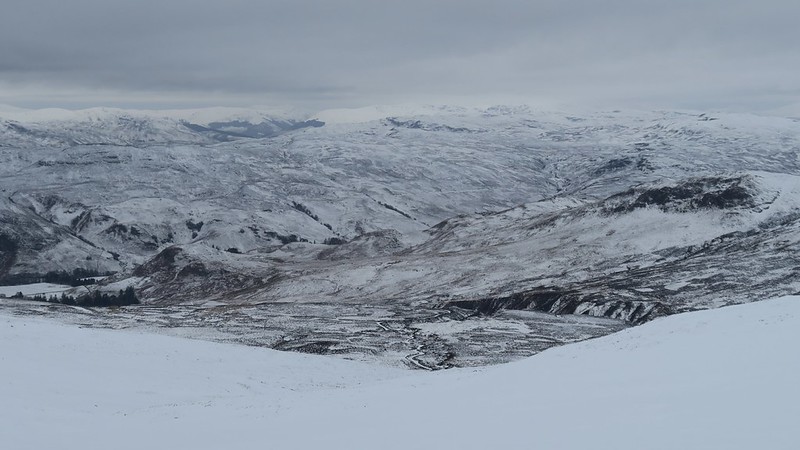
Visibility held reasonably well, though the windchill on the end of my nose was a sharp reminder of how exposed the tops were becoming and how glad I was that everything else was well covered. The views were superb. Snow covered hills rolled away beneath broken cloud while shafts of sunlight lit distant lochs and glens. It was one of those classic Scottish winter scenes.A few quick photos, a short pause to take it in and then it was time to head back before conditions strengthened further.
Dropping off the ridge and out of the wind felt instantly calmer. On the descent we stopped so I could talk my companion through my understandings of the snow pack and how I go about interpreting on the move as we headed up. A hard refrozen base layer with thin cross loaded wind slab and a thick crust above. It was a great chance to see snow structure in real conditions rather than simply read about it.
Near a small melt out hole in the snow over a stream a tiny mammal darted around the rocks, most likely a vole, apparently completely unconcerned by our presence.
Moments later a white mountain hare bounded effortlessly up the slope, making our careful crampon progress look wonderfully inefficient. Lower down we finally met the first walkers of the day, followed by a couple of skiers skinning steadily uphill. It felt rather special to have had the mountain almost entirely to ourselves for the morning. Soon we were back past the dam and down to the car. The ice on the track was already starting to soften another quiet sign that the timing had worked. One of those moments when I was very glad to have snow socks, de-icing salt and a shovel in the boot as we headed back to the hostel.
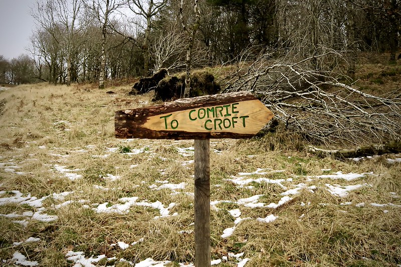
Comrie Croft
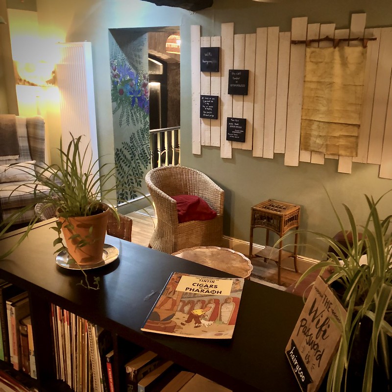
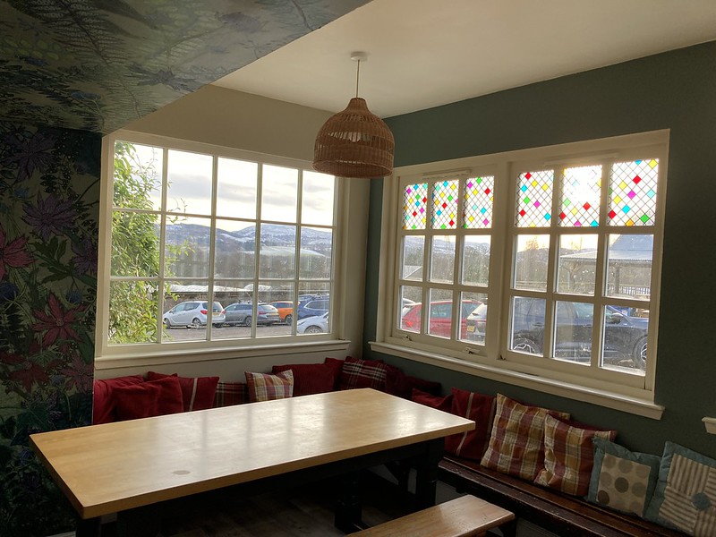
Some places are simply somewhere to sleep and other quietly shape how you experience the landscape. Comrie Croft falls firmly into the second category.

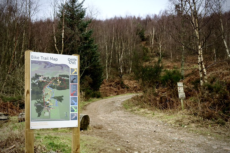
From the moment you arrive it feels more like an outdoor basecamp than a hostel: part café, part trail centre, part community hub. Muddy bikes are by the door and maps cover the walls inviting exploration rather than prescribing it. Step straight out from the hub and you’re already moving through mixed rewilding woodland: young native trees forming wildlife corridors across what was once grazing land. It’s a living landscape, slowly healing while still welcoming runners, riders and walkers through it. The purpose-built mountain bike trail network weaves through the woods in looping climbs and flowing descents, from gentle green routes to steep technical blacks. There are limited trails on their land for walkers although the view from the top watching the sunset that was something special.
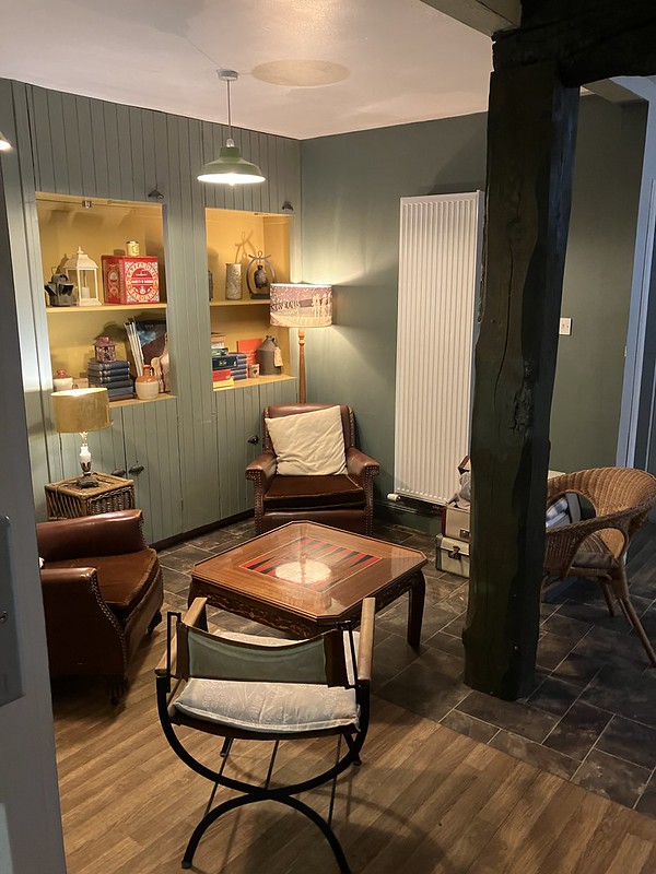
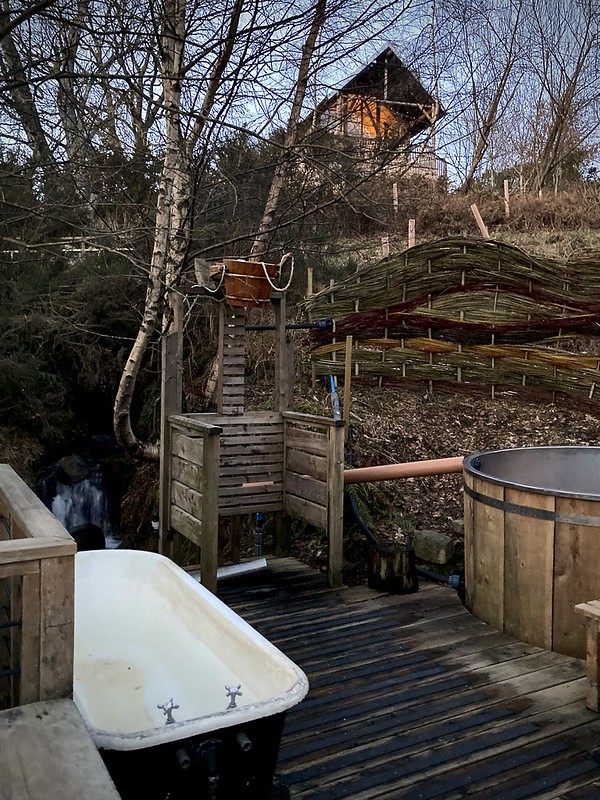
After days outside, the Croft draws you back in gently with a hot drink in the café, a wander uphill to the simple stone bench perfectly placed for sunset and watching light spill across the hills as the valley softens into evening. There’s even a small nature sauna tucked into the campsite by a pond. It’s the sort of place that doesn’t just support adventure, it quietly encourages it.
We’d planned a quieter day and with the forecast set to deteriorate we had breakfast, I gabbed my running bum bag, with a couple of bars, water, water proofs and off we went. These are some of my favourite days, moving through landscape with no real plan just to explore and take in what we find on the way.
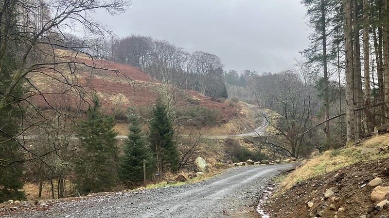
Forest tracks carried us gently upward between bike routes, snow beginning to gather in shaded hollows and after a little bit of luck we found our way on to commercial forestry tracks and after a bit of retracing our steps we were on the hillside, once part of a classic Highland estate system: parkland near the house, woodland beyond and high moor kept open for grazing and sport.
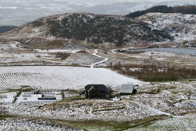
A deer fence marked the boundary between modern forest and open hill, a sharp line across what was once continuous estate ground.
Passing a small hill lochan with a father and son getting ready for some fishing; nearby was the restored remains of an old shooting lodge near Braefordie. Which I imagine is still a base for deer stalking now as it was during the height of Victorian sporting estates. Today it’s been extended and restored, although its position still tells the story of how these hills were once worked for sport rather than recreation. Broad tracks led us first towards Loch Turret Reservoir, the trail goes all the way there although for us we just enjoyed the open upland view before heading towards Carn Chois until the path steeped a little and then we decided against following it as it goes up all the way to Ben Chonzie where we had been the day before. This felt like a landscape built for long journeys.
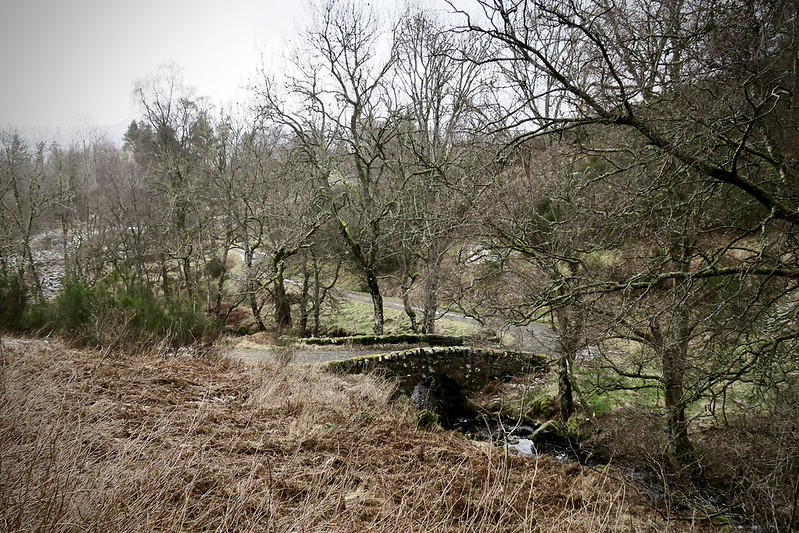
As we headed back conifers thinned into deciduous woodland, moss crept across stonework and the burn deepened its channel. Almost hidden among the trees stood the Old Humpback Bridge; an arched stone crossing likely built in the late 18th or early 19th century to carry horses, timber carts and estate workers across Balmenoch Burn. Its humped profile allowed floods to surge beneath; a simple, enduring design from another era.
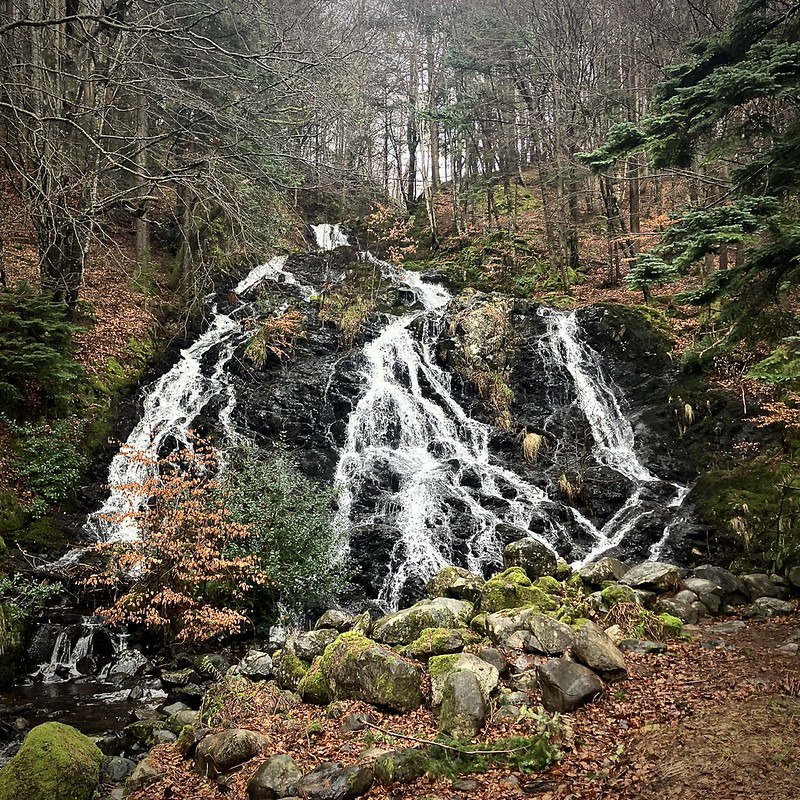
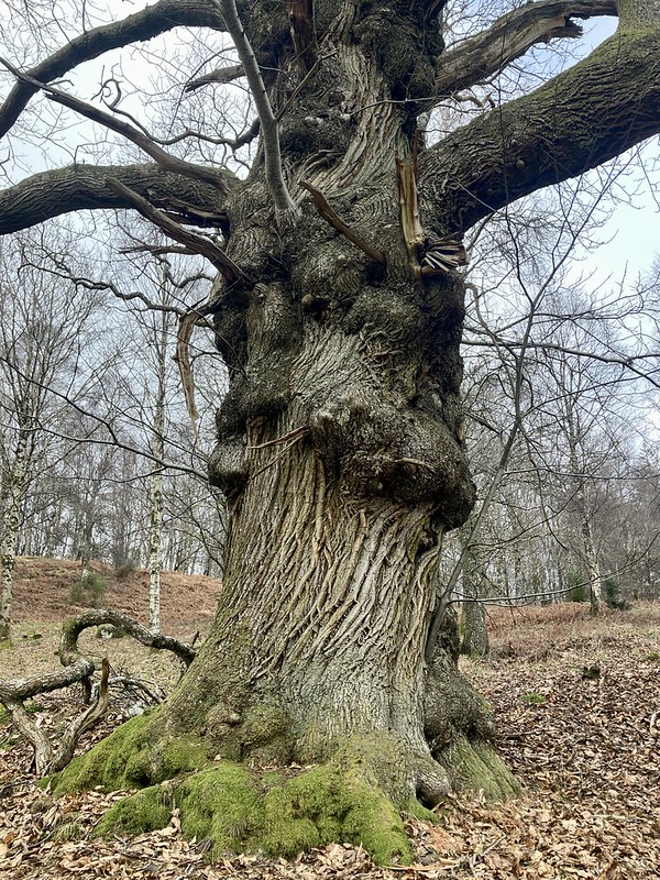
Just upstream a little down stream water slipped over a small waterfall, likely once shaped or cleared to form a picturesque feature along estate walking routes. Then on our way back to the croft we had a little detour to visit the ancient sweet chestnut trees. I imagine they were planted two to three centuries ago as ornamental parkland specimens. Living witnesses to the land’s transformation from manicured estate to sporting hills, forestry and now rewilding landscape.
By the time rain finally arrived we were back at the Croft; soup warming from the shop on site and weather drumming gently outside. A perfect ending to a day that quietly turned into something far richer than planned.
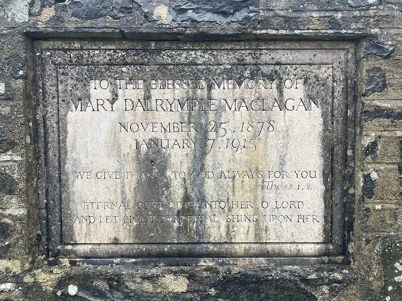
Our last morning at the croft slowed the pace, after packing up and loading the car we took an easy wander led out of the Croft toward Comrie itself wanting to see the Giant Redwoods on the way, then climbing gently toward the hilltop monument that looks out across the strath. Although as is often the way the highlight came by accident. Following what looked like a faint path toward a viewpoint, we noticed Strava heat maps simply stopped in one spot; a curious digital clue layered over the physical landscape. Hidden just off the main track lay a small enclosed memorial plot linked to the Maclagan family: peaceful, overlooked and not marked on conventional maps at all. A quiet reminder that technology now sits alongside traditional navigation, sometimes revealing places that paper mapping never recorded.
Then we retraced back to the croft peaking from a distance at the walled garden and then it was time to head off after a spot of lunch.
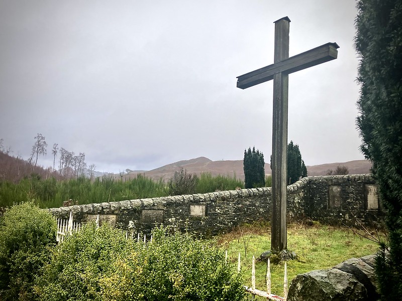
Returning to Cultybraggan
The base camp for the 2011 Original Mountain Marathon sat just outside the Perthshire village of Comrie, at Cultybraggan Camp.
When I first arrived there in October 2011, my focus was almost entirely on the race. The OMM has a way of narrowing your attention. Maps to study, kit to pack, weight to trim, weather forecasts to interpret. Everything becomes about the next two days in the hills. But even then the place stood out. Rows of Nissen huts stretched across the site, their curved roofs and long straight lines giving the area a distinctly military feel. It was clear this wasn’t just another event field or campsite. Something older sat behind it. My friend and I wandered around for a while the evening before the race.
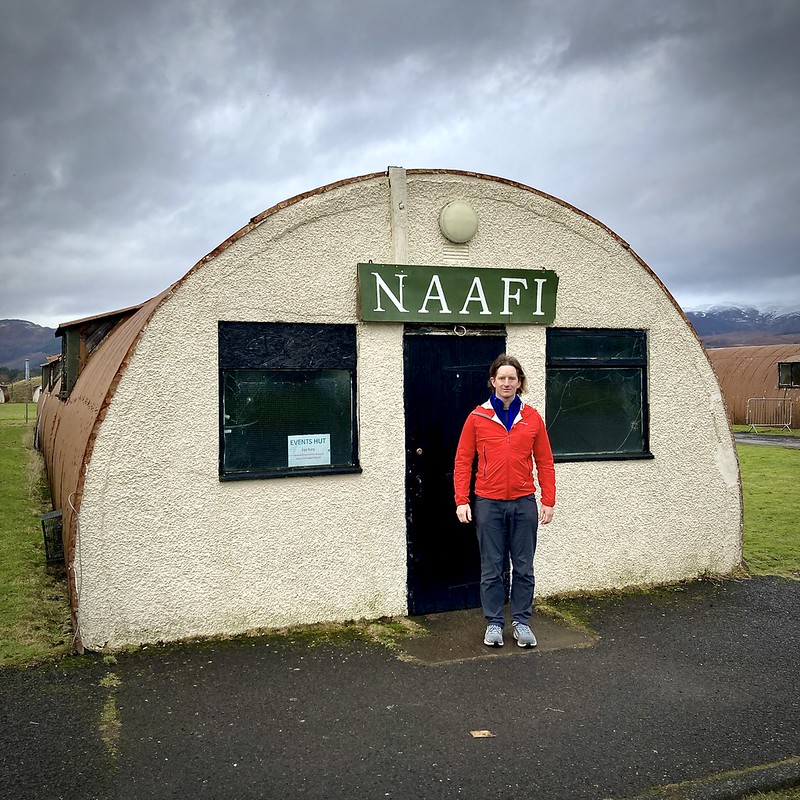
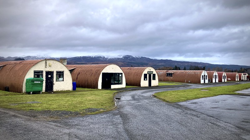
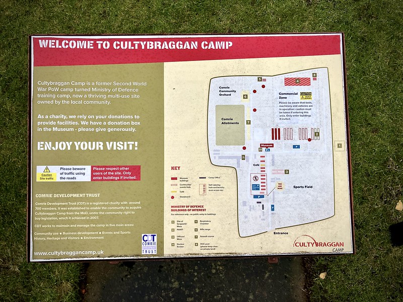
Fifteen years later, in February 2026, I found myself back again. This time there was no start line to think about, no kit check, no controls to plan. Just time to properly look around and learn a bit more about the place. Cultybraggan was built in 1941 as Prisoner of War Camp No. 21, eventually holding thousands of German prisoners captured during the Second World War. The huts that runners parked beside in 2011 were once part of a tightly controlled compound system surrounded by barbed wire and watchtowers. The camp later became known as one of the highest security POW camps in Britain.
Walking around it now, without the bustle of the OMM base camp, the scale of it becomes clearer. We wandered more slowly, reading the history boards and imagining the lives that once unfolded here. And it made the memory of that OMM weekend feel even further away not just fifteen years in time, but part of a much longer history layered into the same patch of ground.
Soon enough the road began to pull us south again. Past the Southern Uplands and back toward the familiar landscapes further south. What stays with me from trips like this is rarely the summit itself. It’s the quieter details: the discipline of navigating in a whiteout on Mount Keen, the wind biting across the ridge of Ben Chonzie, the delicate threads of hair ice beside a woodland burn, the long history written quietly into places like Cultybraggan and Comrie Croft and the reminiscing to watching the adventure show on BBC Scotland and so many races and places covered by this show in my own journey.
Scottish winter rarely gives you perfect conditions, but perhaps that’s the point. It teaches patience, judgement and respect for the mountains in a way blue skies never quite can. And somewhere along the long road home you begin to realise you’re already looking forward to the next return north.